RESEARCH PROJECTS AND GRANTS


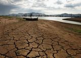
  • 2020 ARC Discovery DP200101875: Environmental and cultural change along the Central Murray River (~380,000 AUD)
  • 2020 ANSTO Research Portal Proposal 12375 (with E. De Carli et al.): Reconstructing a Holocene palaeoflood archive for the Murray-Darling Basin, a proxy record for eastern Australia's hydroclimatic variability (~36,000 AUD)
  • 2019 GeoQuEST Small Grant (with E. De Carli et al.): Dating and provenancing sediments of a palaeoflood record at the terminus of the Murray-Darling Basin (~8,670 AUD)
  • 2019 SGeoQuEST Small Grant (with E. De Carli et al.): Developing a Holocene palaeoflood archive for the Murray-Darling Basin (~4,880 AUD)
  • 2019 GeoQuEST Small Grant (with S. Marx et al.): Assessing the role of aeolian sediment in controlling fluvial dynamics along desert margins (~5,000 AUD)
  • 2019 ANSTO Research Portal Proposal 12207 (with A. Flatley et al.): Towards linking long-term denudation and modern fluvial dynamics in the Pilbara (~43,000 AUD)
  • 2019 ANSTO Research Portal Proposal 12224: Erosional timescales and the antiquity of Arnhemland Plateau (NT) as inferred from cosmogenic nuclides (~40,600 AUD)
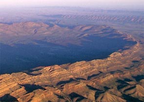
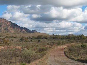
  • 2019 ANSTO Research Portal Proposal 11956: Constraining late Cainozoic uplift and erosion in the arid north-eastern Flinders Ranges (~17,300 AUD)
  • 2018 GeoQuEST Small Grant (with Dr. S. Marx et al.): Assessing the role of aeolian sediment in controlling fluvial dynamics along desert margins (~4,800 AUD)
  • 2018 ANSTO Research Portal Proposal 11681: Quantifying timescales and rates of bedrock erosion by wind abrasion in the Payunia yardang field, Argentina
  • 2017 School of Geography Equipment Grant: A portable and safe percussion coring set (~15.570 AUD)
  • 2017 GeoQuEST Small Grant (with Dr. S. Marx et al.): Exploring archives of long-term dust deposition in Central Australia (2.975 AUD)
  • 2016 DLR Proposal for the Utilization of TerraSAR-X / TanDEM-X Data for Scientific Use, Project GEOL 0665: Exploring the use of TanDEM-X elevation data for the geomorphic quantification of small-scale, irregular erosional landscapes at Zhangjiajie sandstone peak forests, Hunan, China (equivalent value ~ 2.000 AUD)
  • 2016 Universidad de Cuyo, Mendoza, Argentina, SECTYP 2016-2017, Código 06/A669 (with Dr. S. Moreiras): El rol de los deslizamientos en el balance sedimentario y comportamiento hidrológico de las cuencas andinas: Historia paleo-ambiental e hidrodinámica actual en los Andes Centrales (~800 AUD)
  • 2016 Wiss. Gesellschaft Freiburg Sachmittelbeihilfe (scientific expenses small grant): Gammaspektrometrie-Messungen zur Altersbestimmung von eiszeitlichen Ablagerungen im Oberrheingraben (~1.450 AUD)
  • 2015 DAAD Travel Grant for 19th INQUA Conference (3.800 AUD)
  • 2014 GeoQuEST Small Grant (with Prof. G. Nanson et al.) - "Why are so many Australian rivers straight" (5.000 AUD)
  • 2014 AINSE Research Award, (covered by SMAH UOW): Refining the chronologyof late Pleistocene post-depositional pedogenesis in the Flinders Ranges, SA (2.480 AUD)
  • 2013 AINSE Research Award, Project ALNGRA13020: A paired-dating approach to constrain late Pleistocene to Holocene incision in the Flinders Ranges, SA (3.800 AUD)
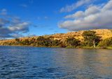
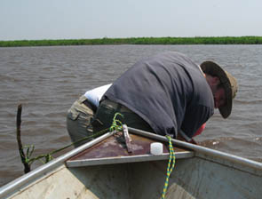
  • 2013 UOW Small Grant 104573 (Dr Samuel Marx et al.): Palaeo-flow characteristics of the catchments of the Murray-Darling Basin: Understanding climate/water interactions in semi-arid south-eastern Australia (~10.000 AUD)
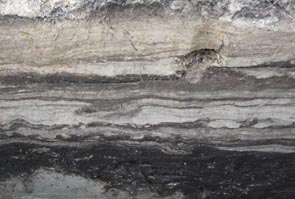
  • 2013 GeoQuEST Small Grant: Dating Holocene speleothems in the arid Flinders Ranges (1.500 AUD)
  • 2013 GeoQuEST Small Grant (with Dr Samuel Marx et al.): A history of lake filling events in central Australia (4.000 AUD)
  • 2012 SEES Equipment Grant (with Dr Tim Cohen et al.): Motor driven percussion coring device (~20.000 AUD)
  • 2012 Discovery Early Career Research Award (DECRA), Project DE120103033: The wet and dry of tropical Australia: past, present and future (375.000 AUD)
  • 2012 RIBG (with Dr Anthony Dosseto et al.): Surface area analyser with applications to geoscience, archaeology, material sciences and engineering (74.750 AUD)
  • 2011 18th INQUA Conference Financial Assistance Grant for Young Researchers (1.400 ? / ~1.740 AUD)
  • 2010 NSFC fellowship for young researchers: Alluvial Fans and Quaternary Incision along the Upper Yellow River (160.000 ¥ / ~24.800 AUD)
  • 2010 ARC Discovery Project (Prof Gerald Nanson et al.): How green were our deserts? Evidence for Late Quaternary climate change and the source of water in the Lake Eyre Basin
  • 2009 SNF fellowship for prospective researchers, Grant PBBEP2-125564: Mid- to Late Quaternary flow regimes in the Flinders Ranges, South Australia, and the relative roles of the monsoon and the southern westerlies (44.800 CHF / ~ 45.800 AUD)
  • 2008 SNF-200021-122289/1 (authored): Holocene hydrogeomorphology in the Llanos de Moxos, NE Bolivia (461.302 CHF / ~471.900 AUD)
  • 2008 Berne University Research Foundation, Grant 31/08: Geoarchaeology and pre-Columbian landscape evolution of the Llanos de Moxos, NE Bolivia (6.700 CHF / ~6.850 AUD)
  • 2007 IGBP Swiss Committee Swiss 7th global Change day 2007 Poster Award (1.000 CHF / ~1.020 AUD)
  • 2006 ASG (Swiss Association of Geography) Young Researcher Travel Grant (500 CHF / ~510 AUD)
  • 2004 SNF 200020-105228/1 (authored): Paleoecology of Eastern Bolivia (168.758 CHF / ~172.600 AUD)
  • 2004 SNF 21-067937.02/1 (Prof Heinz Veit): Paleoclimate and landscape evolution in the tropical Andes of Bolivia and the adjacent lowland rainforest
  • 2001 Diploma Thesis: The Quebrada de Purmamarca, Jujuy, NW-Argentina: Landscape Evolution and Morphodynamics in the Semi-Arid Andes (Diploma Thesis)
  • 2000 Student Research: Geomorphologie und Paläoumweltforschung im Jemen


Palaeo-flow characteristics of the catchments of the Murray-Darling Basin: Understanding climate/water interactions in semi-arid south-eastern Australia

Financed: UOW Small Grant 104573

2013

The aim of this project is to develop a more robust understanding of climate variability and water availability in the Murray-Darling Basin (MDB). This will be achieved through constructing paleo-flow records for the rivers of the MDB, Australia's principal agricultural region. Specifically the project aims to (i) establish a high resolution (decadal to centennial) record of the palaeo-flow regimes of the rivers of the MDB over the last 15,000 years through an innovative approach where flow regimes are modelled using the geochemistry of deposited river sediments, (ii) develop an understanding of the complex behaviour of climate cycles through time and identify their role in driving global climate variability, (iii) determine and quantify the role of climate cycles in influencing water availability within the MDB, and (iv) provide information on the likely response of the MDB to climate change by investigating how the basin has behaved under different climate regimes in the past.


The wet and dry of tropical Australia: past, present and future

Financed: ARC DE120103033

2012-2014

This project aims at reconstructing flow regime changes of rivers in the monsoonal 'Top End' of Australia over the last glacial cycle. It documents, chronologically constrains, and interprets fluvial and alluvial deposits in selected catchments based on an integrative and innovative combination of new drilling techniques, single-grain luminescence dating, and quantification of flood magnitudes. Thereby it significantly improves the understanding of the causes and mechanisms underlying the variations in tropical rainfall on the Australian continent, providing crucial knowledge required in planning for an environmental sustainable Australia, and adequately responding to scenarios of future climate change.


Alluvial Fans and Quaternary Incision along the Upper Yellow River

Financed: CAS scholarship for 'Distinguished Foreign Young Scientists'

2010-2011

The headwaters of the Yellow River play a crucial role for the contemporary hydrology across its entire basin. However, important questions in the longer-term evolution along the Upper Yellow River still remain unanswered. Contrasting data and opinions have been published about the timing and processes of fluvial incision and subsequent river capture in the dynamic tectonic setting of the NE Tibetan Plateau. Even less is known with regard to late Quaternary paleoenvironmental and paleoclimate changes, although climate is a first-order control on the longer-term evolution of fluvial systems. In order to clarify these issues, the proposed project will provide new geomorphic and chronologic data from the Tongde basin (Qinghai province). Our project chooses an integrative landscape approach, which investigates the spatial and temporal links between the different landforms (terraces, alluvial fan, paleodunes and loess), and thus takes ALL available information into account for landscape reconstruction as well as the interpretation of geomorphic processes and their controls.


How green were our deserts? Evidence for Late Quaternary climate change and the source of water in the Lake Eyre Basin

Financed: ARC DP0667182

2010-2012

This project investigates when central Australia was significantly wetter than now, and if it was warmer or cooler at those times. It will resolve from which oceans and air masses the water came and which deposits provide evidence for periods of sustained wetness and which are evidence of infrequent extreme events. It will solve the fundamental question concerning the timing of wet-dry cycles in relation to the global climate forcing and the source of the fluctuating water supply to the large and agriculturally important eastern Lake Eyre basin (LEB). It will supply reliable data for the rational modelling of changing moisture in central Australia due to climate change and will provide valuable evidence for the future direction of climate change in the LEB on a warmer Earth.


Mid- to Late Quaternary flow regimes in the Flinders Ranges, South Australia, and the relative roles of the monsoon and the southern westerlies

Financed: SNF scholarship PBBEP2-125564

2009-2010

Fluvial systems constitute an important archive for the reconstruction of Quaternary paleoenvironments and –climates. Particularly stable isotope analyses on carbonates formed in fluvial sediments have large potential to provide quantitative information about past climate changes. In climatically sensitive areas, e.g. subtropical drylands, not only temperature and precipitation amounts can thus be reconstructed, also the roles of various atmospheric circulation systems, such as the monsoon or the westerlies, are investigated. Therefore, the proposed project aims at (i) mapping, documenting and sampling up to three alluvial fans in the Flinders Ranges, South Australia, and (ii) applying carbon and oxygen isotope analyses to pedogenic carbonates in the sediments. Thus, in combination with luminescence and U/Th dating provided by project partners, Mid- to Late Quaternary changes in flow regimes shall be reconstructed and information on past climate conditions be deduced.


Holocene hydrogeomorphology and pre-Columbian water management in the Llanos de Moxos, Bolivian Amazon

Financed: SNF (200021-122289)

2009-2012

The Moxos plains (Llanos de Moxos) are among the largest inundated savannah landscapes in the world, characterized by a dense and complex fluvial drainage pattern, belonging to the Amazon system. Neither the modern fluvial morphodynamics nor the Holocene variability of the hydrogeomorphological conditions of the Llanos de Moxos is well understood. During the last decades, manifold evidence for wide-spread pre- Columbian human impact on the natural landscape in this area has challenged the myth of an “untouched” Amazonia and replaced it by a picture of densely populated settlements and chiefdoms instead. Nevertheless, almost no field data exist for the interpretation of these human-environmental interactions. Our project will cover a central part of the Llanos de Moxos and contribute to the following objectives: i) Documenting and clarifying the extent, type, age and meaning of anthropogenic earthwork to better understand the interactions between pre-Columbian cultures and the natural environment; ii) Reconstructing the Holocene variability (natural background conditions) of the hydrological/fluvial system.


Geoarchaeology and pre-Columbian landscape evolution in the Llanos de Moxos, NE Bolivia

Financed: Berne University Research Foundation (31/08)

2008

The main objective of this project is the detailed analysis of two landscape elements of possible anthropogenic origin (forest islands and rectangular lakes) in the Llanos de Moxos, NE Bolivia. No field data exist so far regarding the age and architecture of these elements. However, the differentiation between natural processes and anthropogenic activity is essential for the interpretation of type and intensity of pre-Columbian impact on this lowland ecosystem. Thus, the planned field campaign and all related analysis are integrated into the larger framework of ongoing paleoecological research in the Bolivian lowlands, aiming at an improved understanding of human-environmental interactions in Amazonia: i) in how far were pre-Columbian human civilizations dependent on the prevailing environmental conditions and their changes in the past, ii) how did humans benefit from the natural environment, and iii) what kind of impact on the ecosystem did they have?


Paleoecology of Eastern Bolivia

Financed: SNF (200020-105228/1)

2005-2006

The main objective of the project is the reconstruction of landscape and climate history in tropical eastern Bolivia since the last ice age and the expansion and confirmation of results from the ongoing research within past projects (e.g. SNF 21-067937.02/1). The investigations take place in the Bolivian lowlands around Santa Cruz (Paleosol-Sediment-Sequences, Fluvial Geomorphology), being complemented by studies in the Cordillera de Cochabamba (Glacier-Climate-Modeling, Glacial Chronologies using Cosmogenic Nuclides).


Paleoclimate and landscape evolution in the tropical Andes of Bolivia and the adjacent lowland rainforest

Financed: SNF (21-067937.02/1)

2003-2004

The main aim of the project was the reconstruction of landscape and climate history in tropical eastern Bolivia since the last ice age. Most investigations took place in the Bolivian lowlands around Santa Cruz, but were complemented by studies in the Cordillera de Cochabamba. In addition to the analysis and interpretation of remote sensing data with regard to landscape evolution, the investigations in the Bolivian lowlands focused mainly on the documentation and analysis of paleosol-sediment-sequences (fluvial and eolian sediments, but also slope deposits), which were dated using C14 and OSL dating methods. Most studies in the Cordillera de Cochabamba were concerned with the modeling of climate-glacier relations in the Eastern Cordillera. In order to establish a reliable chronology, various moraine sequences were sampled for age dating using the method of exposure surface dating. In addition to the analysis and interpretation of remote sensing data with regard to landscape evolution, the investigations in the Bolivian lowlands focused mainly on the documentation and analysis of paleosol-sediment-sequences (fluvial and eolian sediments, but also slope deposits), which were dated using 14C and OSL dating methods. Most studies in the Cordillera de Cochabamba were concerned with the modeling of climate-glacier relations in the Eastern Cordillera. In order to establish a reliable chronology, various moraine sequences were sampled for age dating using the method of exposure surface dating. [Report]


The Quebrada de Purmamarca, Jujuy, NW-Argentina: Landscape Evolution and Morphodynamics in the Semi-Arid Andes (Diploma Thesis)

Financed: -

2001-2002

The aim of the presented study has been the reconstruction of a landscape evolution for the Quebrada de Purmamarca in NW-Argentina. Thorough mapping of the landforms and the description of the present morphodynamic situation are the starting point for further observation. One of the essential outputs of the study is a geomorphological map of the study area. Mapping has been supplemented by sedimentological and pedological observations. According to basic morphogenetic principles, the combined results have been ordered chronologically. This way they could finally form the base for landscape evolutionary interpretation with particular regard to the discussion of paleoclimate. Various methodological approaches complementing each other have been used. From LANDSAT TM 5 data, high-resolution CORONA satellite imagery and aerial photography, inaccessible parts of the study area could be included in the investigation. In addition these data served overview purposes and have been used as the base for mapping. The main emphasis of this study, however, are the results obtained from several weeks of field work. Aside from geomorphological mapping, field work focused on the description of numerous sedimentological and pedological profiles. The analysis of these profiles was supported by laboratory data from field samples (granulometry, CaCO3 content) but also by a 14C age date. With particular regard to pedological questions, several samples from soil crust were micromorphologically analysed and interpreted. In conclusion, based on these data, several phases of landscape evolution have been reconstructed for the Quebrada de Purmamarca. Depending on their timescale, the different phases show evidence for different controls of landscape change.


Geomorphologie und Paläoumweltforschung im Jemen

Financed: -

2000

Unter der steigenden Zahl geowissenschaftlicher Untersuchungen im Jemen sind geomorphologische Arbeiten bislang die Ausnahme. Gerade im Zusammenhang mit hydrologischer und geologischer Forschung hat die Geomorphologie aber heute eine Reihe von anwendungsbezogenen Möglichkeiten, trägt sie doch zu einem tieferen und umfassenderen Verständnis der Umwelt bei. Während die geomorphologische Feldforschung immer auch abhängig ist von politischen Umständen, sind es in zunehmendem Masse frei verfügbare Fernerkundungsdaten, die nicht nur dem Fachmann, sondern auch dem landschaftlich interessierten Jemen-Reisenden einen Überblick sowie detaillierte Einblicke in die enorme landschaftliche Vielfalt des Jemen vermitteln können.